College of Engineering Unit:
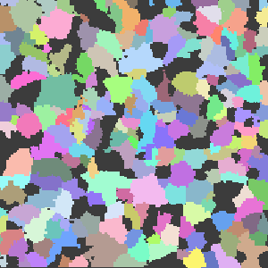
Tree Segmentation is a crucial process in forestry, enabling the extraction of topological information from forests, including individual peaks and crowns. This information provides valuable insights for forestry professionals. This plugin makes use of a novel segmentation algorithm, co-created by Bogdan M. Strimbu, an associate professor at Oregon State University which has exceptional accuracy and efficiency in segmentation.
Our project focuses on developing a plugin for QGIS, a widely used geographic information system and mapping software. This plugin, seamlessly integrated into QGIS, offers a user-friendly graphical interface for parsing LiDAR files of forested areas. The algorithm's output is converted into a shape file format, directly usable and analyzable within QGIS. Additionally, the plugin automatically extracts relevant data about the forested area, such as the tallest tree, shortest tree, and the total number of trees, facilitating simple data gathering for users.
The primary objective of the plugin is to enhance the convenience of working with LiDAR scans of forested areas. While a previous team had successfully developed an algorithm for segmenting LiDAR scans, its usage required advanced knowledge of dependencies and environments. Our goal was to simplify the segmentation process to the point where anyone, regardless of expertise, could utilize the plugin.
By incorporating the novel segmentation algorithm into QGIS, our plugin streamlines the workflow for forestry professionals and researchers. It eliminates the need for specialized expertise in technology, enabling a broader range of users to take advantage of LiDAR scans for forest analysis. With the plugin's ability to generate comprehensive shape files, users can gain valuable insights and make informed decisions regarding forest management, conservation efforts, and ecological research with geospatial modeling.
Potential continuations of this project may include further simplifications for the end-user by removing the requirement for Python and Anaconda. There could also be development into automatically choosing optimal algorithm parameters based on the input to improve segmentation results.
Project Website(s):