Our project is a virtual reality program that works to simulate strategic combat encounters in an urban environment with limited intel of the scene. This simulation works to better combat strategy in terms of squad positioning, processing intelligence, and communicating orders to allied units.
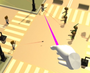
The user assumes the control of a team leader that can give commands to your autonomous teammates. These commands can have your teammates navigate, patrol, and even help each other in combat. The number of enemy combatants may be higher than the number of deployed allies, so the commands given will most likely be the difference between victory and defeat.
The scene itself will only be revealed to the user by what the allied units can currently see, and partially of what has been past seen. This works to help simulate an unknown environment where the only visual intel is from the allied units. This is implemented as the common trope known as Fog of War. This implementation helps prevent the user from having what would be considered impossible knowledge of the battlefield.
A user heads-up-display is displayed to the user to easily track, select, and view allied units. Single or multiple units can be selected at the same time to receive orders. Some application options can be toggled from launch or runtime such as fog of war, unit pathing trails, etc. These options were included to showcase certain aspects of the application under the hood but have no real advantage in the application. So, these options are toggle-able by the user.
The allied and hostile units utilize a finite state machine to determine their current actions and possible coroutines. Primarily vision detection is used to determine the next state, but units can also alert nearby teammates to trouble they have spotted. Alerting these nearby units will have them rush to the encounter. Without visual contact of hostile forces, the autonomous units will continue to search the surrounding areas until contact is made.
Units use a rendered and mapped navigation mesh to navigate the battlefield. The mesh works to mark traversable areas and obstacles that can then be used to calculate pathing routes. These pathing routes are continuously dynamic, meaning that even if a unit is off the mapped mash, that unit will try to path back onto mapped areas.
| Attachment | Size |
|---|---|
| 114.81 KB |